Wise Use
Case Study
2016 The planning and establishment of long-term monitoring of the estuary wetlands in Taipei City.
Date:2019/05/09
Number of Visitors611
Project title
2016 The planning and establishment of long-term monitoring of the estuary wetlands in Taipei City
Project executive agency
Taipei City Government
Project execution team
National Taiwan University and The Society of Wilderness
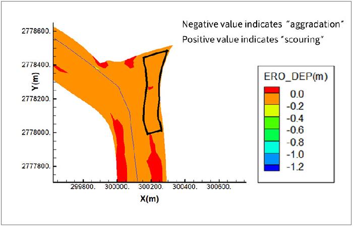
The simulation of the results of aggradation and scouring of the topography in the next 5 years
Features of wetlands
The estuary wetlands in Taipei City are located on river open waters, mudflats, and the intersection of mudflats and floodplains. Most of them are tidal estuaries, with high saline concentration, highly diverse distribution of vegetation, and rich ecological resources. In addition, they also provide important habitats for rare species.
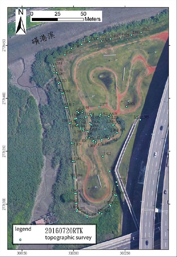
The result of topographic survey
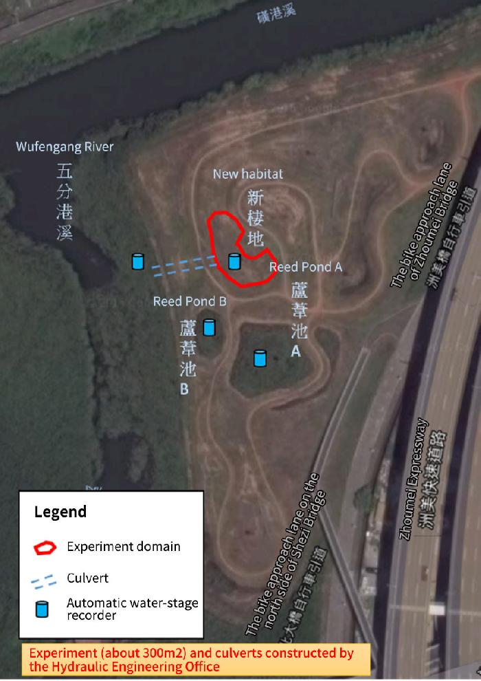
Illustration of the restoration plan of Mortonagrion hirosei’s habitat
Accomplishments of the restoration plan
This plan examines the impacts of natural driving forces on the estuary wetlands in Taipei City with the employment of the hydrodynamic and sediment transport model (SRH-2D) from the aspect of the overall river corridors to analyze the trends of the changes of estuary wetland habitats. Biological and environmental data is collected, analyzed, and surveyed for the construction of the long-term monitoring model for estuary wetlands in Taipei City.
The project has completed the first survey on the synchronic and same location investigation of the biological and environmental factors of Mortonagrion hirosei (Four-spot Midget). The study integrated the biological and environmental factors by the Habitat Suitability Index (HSI). Employing the hydrodynamic and sediment transport model (SRH-2D), it analyzes the trends of the habitat’s future changes. With the findings, it is going to evaluate the changes of the habitat’s environmental quality for the important references of habitat maintenance and restoration construction in the future.
According to the framework of the long-term monitoring survey, it is suggested that a long-term survey of Mortonagrion hirosei should be conducted in the future, including the number of Mortonagrion hirosei community and the characteristics of habitats. Habitat restoration experiments of Mortonagrion hirosei should be conducted on a trial basis. With the long-term monitoring of Mortonagrion hirosei creatures (the number of adults and larvae Mortonagrion hirosei, vegetation, and benthic organisms) at the same time and same location and the environmental factors (topography, water quality, and hydrology), further integrated analysis will be carried out. Integrating the field survey and lab studies, it is going to analyze and examine the distribution and life history of Mortonagrion hirosei.
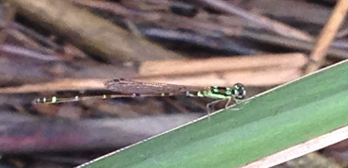
Mortonagrion hirosei
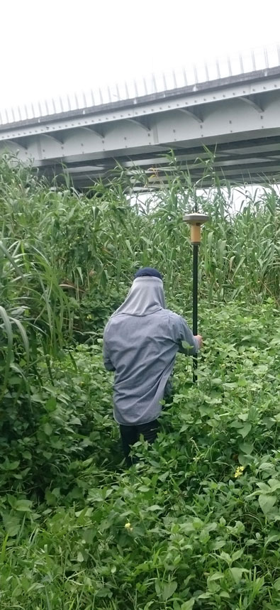
Vegetation survey by Robel Pole Methods
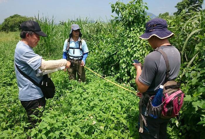
Topographic survey operation
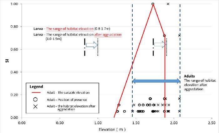
Elevation suitability and habitat changes of Mortonagrion hirosei